The Francis Frith Collection
Francis Frith was a Victorian photographer who founded a photographic views company around 1860. Over the next 110 years the company amassed a collection of photographic views across Great Britain that is a national treasure.
Fortunately, after the original company closed in 1970 when the owner retired, the historic importance of the collection was recognised and it was kept intact. Since then a new company has been established to keep it going, and sells copies of the photographs in a variety of formats. They also have a range of historic maps, books, calendars, and jigsaws.
Below is a selection of views of Hatfield. Most of these date back to the 1950s and 1960s. Copies of the pictures shown (and others in the collection) can be ordered directly from The Francis Frith Collection website. Simply click on any of the pictures to visit this site.
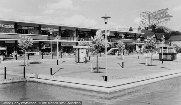
Hatfield market place showing part of the reflecting pool that once spanned
it. Taken around 1965.
Ref: H254048
Reproduced courtesy of Francis Frith.
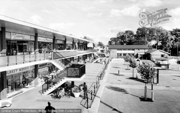
Another view of Hatfield market place. Taken around 1965. Shows how
the Plane trees have grown in over forty years.
Ref: H254053
Reproduced courtesy of Francis Frith.
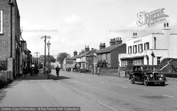
The St Albans Road once ran through the centre of Hatfield as the
photo below, taken around 1955, shows. The Benskin pub on the right is
the White Lion, long since demolished but its name lives on in White
Lion Square. The building on the left is still standing and is used as
a bookies. This section of the road has been pedestrianised and the Asda
supermarket built across it at the bottom.
Ref: H254008
Reproduced courtesy of Francis Frith.
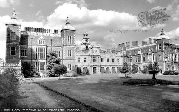
View of the south front of Hatfield House. Completed in 1611, it
hasn't changed much since this photo was taken around 1965 (although the
scaffolding on the east wing has been taken down).
Ref: H254062
Reproduced courtesy of Francis Frith.
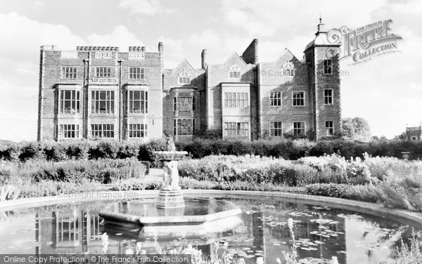
View of the west side of Hatfield House. This is the aspect that can
be seen from the railway station.
Ref: H254061
Reproduced courtesy of Francis Frith.
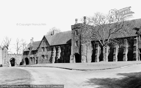
Old Palace – the surviving wing of the palace built in the days when
Hatfield was Bishop's Hatfield. Dates back to the late 15th
Century. Photo taken around 1960.
Ref: H254042
Reproduced courtesy of Francis Frith.
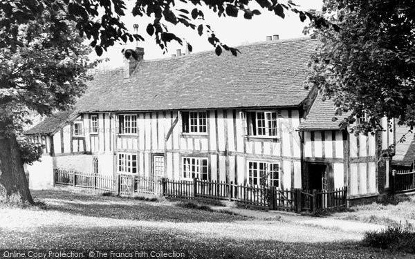
Church Cottage, taken around 1955.
Ref: H254006
Reproduced courtesy of Francis Frith.
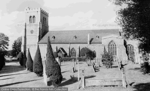
St Ethelreda's Church, seen from Church Street. Taken around 1960. Ref: H254057
Reproduced courtesy of Francis Frith.
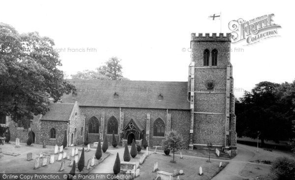
St Ethelreda's Church, seen from Fore Street. Taken around 1965.
Ref: H254082
Reproduced courtesy of Francis Frith.
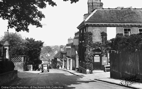
View down Fore Street from the church end. Shows the East India Chief
pub on the corner (long closed and now a private residence). Taken in
1951.
Ref: H254011
Reproduced courtesy of Francis Frith.
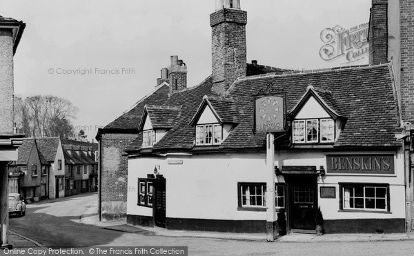
Eight Bells pub at the bottom of Fore Street. Taken around 1960. The
doorway on the left has been bricked up and the window extended.
Ref: H254046
Reproduced courtesy of Francis Frith.
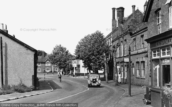
The Great North Road running past the Salisbury restaurant and Dray
Horse pub. Taken in 1948. The route of the road has changed, the
restaurant converted to office space and the pub demolished.
Ref: H254001
Reproduced courtesy of Francis Frith.
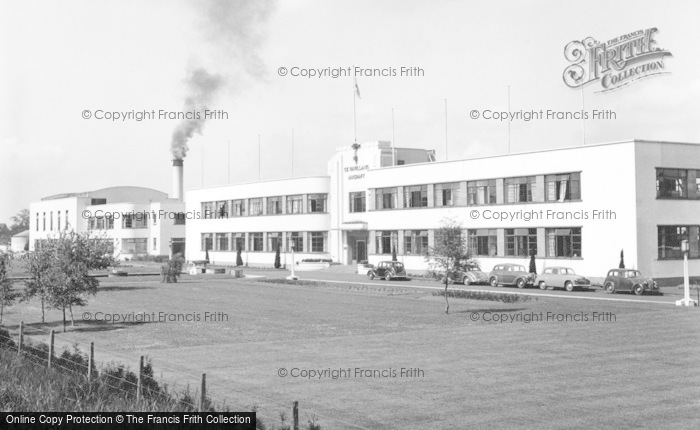
The de Havilland headquarters building and factory. Taken in 1951.
Ref: H254007
Reproduced courtesy of Francis Frith.
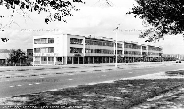
The de Havilland office buildings. Taken around 1965. These buildings
have since been demolished and T-Mobile's headquarters built on the
site.
Ref: H254077
Reproduced courtesy of Francis Frith.
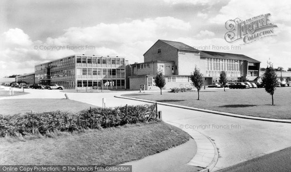
The de Havilland Technical School, later Hatfield Polytechnic, and
now part of the University of Hertfordshire's College Lane Campus. Taken around 1965.
Ref: H254073
Reproduced courtesy of Francis Frith.